|
Green Atlantic Farms Precision Agriculture |
|
We are now providing the services outlined hereunder as well as GPS mapping to potential customers. |
|
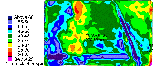
This map shows the disparity of durum yield mainly related to the lack of moisture. However, the center yellow spot shows the effect of a chemical residue carryover from the previous cropping year that affected the growth of the plants. With that type of information we can try different management for different parts of the field. We now have over 9 years of yield data. we are now able to vary the rate of fertilizer according to the potential of the different zones.
Precision Agriculture is a way of optimizing profit per acre. The harvest of reliable information is at its core. However, without proper utilization of this information the results can be counterproductive. |
|
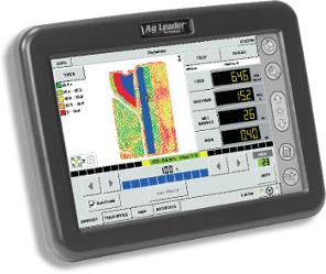
Yield Recording: The yield monitor is a tool to measure crop yield as the crop is harvested. The yield value, crop moisture and elevation are recorded on a storage card every 2 seconds and associated to a location value by latitude and longitude provided by the GPS (Global Positioning System). That value can be viewed in the cab. The yield is usually proportional to the amount of matter entering the machine but at times can be totally unrelated. The storage card is taken later on to a desktop computer and downloaded to produced geo-referenced maps. |
|
Scouting: During the growing season, spend some time checking for potential problems in fields. For example: weeds, insect pressure, disease, etc.
When trouble areas are spotted they are often recorded by GPS to be able to come back later for treatment or to find out what real impact these areas have on production at harvest. The software used is Sitemate from Farmworks. |
|
Guidance: During the crop year we pass over the land several times for seeding, spraying and scouting. For spraying and seeding, for example, the pass width is 90’. Each pass has to be as parallel and accurate as it can possibly be to avoid: 1) Double application, which is a waste of product and can be harmful to the crop. 2) Skips, which are untreated areas .
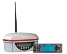
We use Auto steer technology to automatically steer equipment at a precision on less then 2” made possible by an RTK GPS signal correction We have our own correction base station which broadcasts the signal to mobile units. |
|
The world of agriculture, like any other industry, is always influenced by ever changing technologies. One of them is GPS (Global Positioning System). We have worked with some aspects of GPS in the past but are integrating it more and more on the farm in precision agriculture.
GPS is a technology using a signal from space satellites to provide an exact location on earth by latitude and longitude. How can this be used on the farm? |